LiDAR Light Detection and Ranging
GENERAL INFORMATION

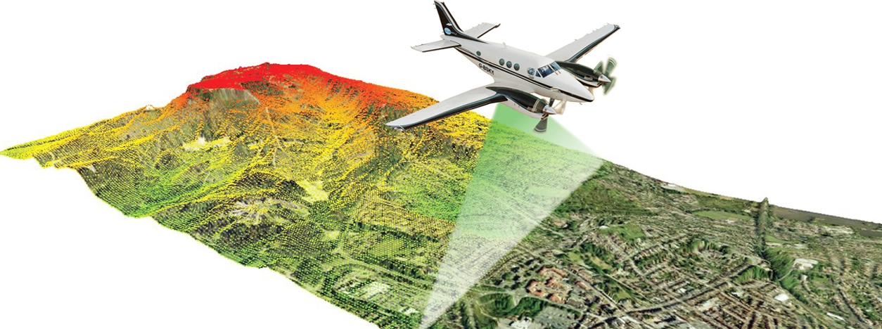
LiDAR (Light Detection and Ranging) is a remote sensing technology that uses laser pulses to measure distances and create high-resolution 3D maps of the Earth’s surface. The technology emits laser beams and measures the time it takes for the laser pulses to return after reflecting off objects on the ground. This data is then used to generate precise elevation models and capture detailed information about the topography, vegetation, buildings, and other features of the Earth’s surface.
LiDAR has become a well-established method for obtaining highly detailed and accurate elevation data in various environments. Recent advancements in lidar technology have improved its capabilities, allowing scientists and mapping professionals to study natural and built environments with exceptional precision and flexibility. LiDAR data is typically collected from airborne platforms such as planes, enabling efficient coverage of large areas in a short time. Ground-based stationary and mobile platforms are also used for LiDAR data collection.
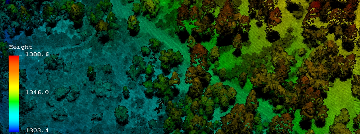
LiDAR offers several advantages over other techniques for collecting elevation data. These include higher resolutions, accuracies on the centimeter scale, and the ability to detect ground surfaces even in forested terrains. The technology has applications in various fields, including land surveying, forestry, urban planning, archaeology, environmental monitoring, and infrastructure development. It provides valuable data for mapping, modeling, and understanding the Earth’s surface and its changes over time.
Understanding key terms related to LiDAR is essential for discussions about accuracy, data collection, and processing. Here are the important terminologies:
- LAS: A binary file format used to exchange 3D point cloud data, primarily designed for lidar. It supports any x, y, z coordinates.
- RMSE: A measure of data accuracy, like standard deviation, when there is no bias. It stands for root mean square error.
- Fundamental Vertical Accuracy (FVA): FVA is a high-confidence measure of data accuracy in open areas, calculated using the RMSE.
- Classification: Categorizing LiDAR data based on the type of objects the laser pulses reflect off, from unclassified to specific classes like buildings or vegetation.
- Return Number (First/Last Returns): Identifies the order of the returns from a single laser pulse, helping determine the source, such as ground or trees.
- Point Spacing: The distance between individual lidar points, determining the resolution of derived gridded products.
- Pulse Rate: The number of laser shots per second emitted by the lidar instrument, typically ranging from 50,000 to 150,000 pulses per second.
- Intensity Data: Records the strength of the laser return, indicating how well the object reflected the laser wavelength.
- RTK GPS (Real-Time Kinematic GPS): Utilizes carrier phase instead of the GPS signal itself for precise satellite navigation, producing more accurate positioning.
- DEM (Digital Elevation Model): A surface representation of topography created from elevation point data, often used in GIS or CAD applications.
TECHNICAL DETAILS
Two common types of LiDAR systems exist, i.e., Airborne LiDAR and Terrestrial LiDAR. Airborne LiDAR systems are mounted on aircraft such as planes or helicopters and are used to collect data over large areas. Terrestrial LiDAR systems are used on the ground and can be either mobile or static. These systems are often used for surveying and mapping applications.
| Type | Description |
| Airborne LiDAR | LiDAR systems that are mounted on aircraft such as planes or helicopters |
| Terrestrial LiDAR | LiDAR systems that are used on the ground; can be either mobile or static |
LiDAR systems typically consist of the following components:
| Term | Definition |
| Laser Source | A laser that emits short pulses of light in the form of laser beams; can operate in different wavelengths such as near-infrared or green |
| Scanning Mechanism | A mechanism that directs the laser beams towards the Earth’s surface; can be a rotating mirror or a multi-beam laser scanner |
| GNSS | Global Navigation Satellite System; used to precisely determine the position and orientation of the LiDAR system |
| IMU | Inertial Measurement Unit. Measures the acceleration and rotation rates of the LiDAR system to compensate for the motion of the platform carrying the LiDAR system |
| Photodetector | A device that detects the laser beams when they reflect off the ground or other objects; records the time it takes for the laser pulses to return |
| Data Acquisition System | A system that collects information from the photodetector, including range measurements and laser emitted intensity |
| GPS | Global Positioning System; a satellite-based navigation system that provides location and time information; used in LiDAR systems to provide accurate location information for the data collected by the system |
| Data Storage | The collected LiDAR data, including range measurements and intensity values, is stored for further processing and analysis |
The table below overviews typical or allowed resolutions for common LiDAR missions. However, the spatial resolutions in the table are approximate ranges and can vary depending on specific mission requirements, sensor capabilities, and data processing techniques. Spectral resolution may not apply to LiDAR as it primarily deals with distance measurements using laser pulses. Temporal resolution depends on whether the acquisition is a single event or repeated over time. Radiometric resolution refers to the level of detail in capturing and representing the intensity or reflectance values of the recorded data.
| Typical or Allowed Resolutions for Common LiDAR Missions | ||||
| LiDAR Mission | Spatial Resolution | Spectral Resolution | Temporal Resolution | Radiometric Resolution |
| Topographic Mapping | 1-5 meters | N/A | Single acquisition | 8-16 bits |
| Forestry | 5-10 meters | N/A | Single acquisition | 8 bits |
| Urban Mapping | 10-30 centimeters | N/A | Single acquisition | 8-16 bits |
| Bathymetric Mapping | 10-30 centimeters (depth) | N/A | Single acquisition | 8-16 bits |
| Coastal Zone Mapping | 10-50 centimeters (land-water) | N/A | Single acquisition | 8-16 bits |
| Vegetation Canopy Profiling | 10-50 centimeters | N/A | Single acquisition | 8 bits |
| Power Line Inspection | 5-10 centimeters | N/A | Single acquisition | 8 bits |
| Archaeological Mapping | 5-10 centimeters | N/A | Single acquisition | 8-16 bits |
| Infrastructure Monitoring | 10-30 centimeters | N/A | Single or periodic acquisitions | 8-16 bits |
MAIN APPLICATIONS AND DATA ACCESS

LiDAR data is used for a wide range of applications. LiDAR-derived surface models are fundamental for modeling microclimates. LiDAR provides spatially continuous, sub-meter-scale information on two key climate modifiers at the ground-atmosphere interface: ground topography and vegetation structure. This information can be used to construct microclimate maps by relating microclimate measurements taken on the ground using sensor networks to LiDAR structural information using statistical modeling approaches. These maps can provide detailed information about the microclimate of an area.
Other main applications include:
- Topographic Mapping: LiDAR can create highly accurate elevation models, enabling detailed mapping of terrain features, water bodies, and vegetation.
- Urban Planning: LiDAR helps in urban planning by providing precise 3D models of buildings, infrastructure, and urban areas. It aids in analyzing city growth, assessing flood risks, and optimizing transportation networks.
- Forestry and Agriculture: LiDAR can measure forest canopy height, tree density, and biomass, assisting in forest management and monitoring deforestation. In agriculture, LiDAR aids in crop health assessment and precision farming.
- Archaeology and Cultural Heritage: LiDAR is used to identify and map archaeological sites, ancient structures, and cultural landscapes. It helps in uncovering hidden features and preserving cultural heritage.
- Flood modeling: LiDAR is used in flood modeling to map floodplains and identify areas that are at risk of flooding. This helps emergency managers to plan for and respond to flood events.
- Coastal zone mapping: LiDAR is used in coastal zone mapping to map coastlines and identify areas that are at risk of erosion or flooding. This helps coastal managers to plan for and mitigate the impacts of sea level rise and coastal storms.
- Autonomous vehicles: LiDAR is used in autonomous vehicles to provide a 3D image of the vehicle’s surroundings. This helps the vehicle to identify objects and navigate safely.
RELATED LINKS AND ADDITIONAL RESOURCES
Further background information about Landsat
- NOAA Ocean Service Education: What is LIDAR? – This is a webpage from the National Oceanic and Atmospheric Administration (NOAA) that introduces LiDAR technology and its applications.
- NEON Science: LiDAR Basics – This is a tutorial from the National Ecological Observatory Network (NEON) that provides an introduction to LiDAR technology and its applications.
- Lidar 101: An Introduction to Lidar Technology, Data, and Applications – This is a document from the National Oceanic and Atmospheric Administration (NOAA) Coastal Services Center that provides an introduction to LiDAR technology, data, and applications.
- 3D Elevation Program Standards and Specifications – This is a webpage from the US Geological Survey (USGS) that provides information on the standards and specifications for the 3D Elevation Program (3DEP), which includes LiDAR data.
- ScienceDirect: Light Detection and Ranging – an overview – This is a webpage from ScienceDirect that provides an overview of LiDAR technology.
Accessing and working with Landsat data
- USGS Earth Explorer – This is a data portal from the US Geological Survey (USGS) that provides access to a variety of remote sensing data, including LiDAR data.
- OpenTopography – This is a data portal that provides access to high-resolution topographic data, including LiDAR data.
- National Map – This is a data portal from the USGS that provides access to a variety of geospatial data, including LiDAR data.
- NOAA Digital Coast – This is a data portal from the National Oceanic and Atmospheric Administration (NOAA) that provides access to coastal geospatial data, including LiDAR data.
- US Interagency Elevation Inventory – This is a data portal that provides access to elevation data from multiple federal agencies, including LiDAR data.
*LiDAR data is not as widely accessible or consistently available as other remote sensing data sources such as Landsat or Sentinel. While there are several free sources for LiDAR data, the coverage and availability of this data can vary depending on the location and specific requirements of the user. Additionally, LiDAR data is often collected for specific projects or purposes and may not be available consistently or operationally like other remote sensing data sources.
For the MultiCAST project, the following services have been used to obtain LiDAR data:
- Progetto PST dati Lidar • Viewer – These are two portals from the Italian Ministry of Environment that provide access to LiDAR data.
- ICGC Lidar Data – This is a portal from the Institut Cartogràfic i Geològic de Catalunya that provides access to LiDAR data.
- NOAA Coastal Lidar Data – This is a portal from NOAA that provides access to coastal LiDAR data.
*Images from
https://www.neonscience.org/resources/learning-hub/tutorials/lidar-basics

