PLANETSCOPE MISSION
GENERAL INFORMATION

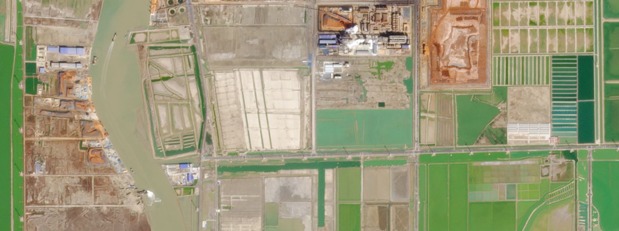
Planet Labs Inc., a public Earth imaging company based in the United States, operates the PlanetScope satellite constellation. The constellation consists of over 200 small satellites that capture high-resolution imagery of the Earth’s surface. The mission aims to provide frequent and global coverage, enabling various applications in agriculture, forestry, environmental monitoring, urban planning, and more.
The company operates its own ground station network to receive and process satellite data. The imagery captured by PlanetScope satellites has a wide range of applications and is used by governments, researchers, businesses, and individuals worldwide. By leveraging a large fleet of satellites, PlanetScope ensures frequent revisits to any point on Earth, enabling the monitoring of dynamic changes and providing valuable insights for a wide range of applications.
With its mission to image Earth every day (a daily collection capacity of 200 million km²/day), PlanetScope contributes to various fields, including environmental monitoring, agriculture, disaster response, urban planning, and many others. The continuous availability of high-resolution imagery plays a crucial role in understanding and addressing global challenges.
PlanetScope Missions
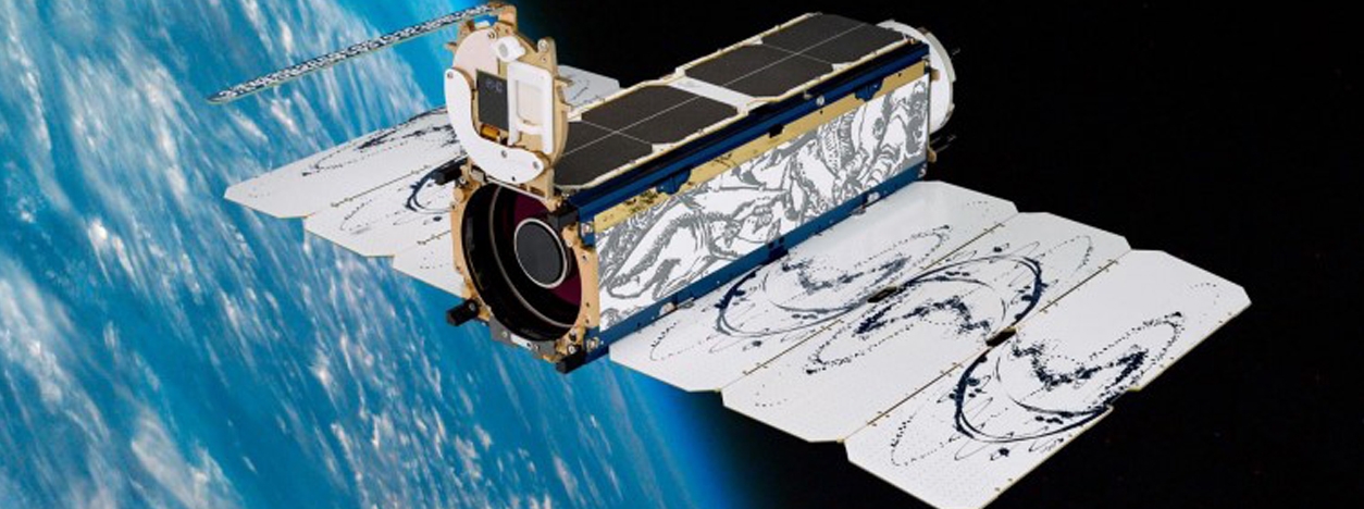
Planet designs, builds, and operates ultra-compact, inexpensive cubesats which can be manufactured in bulk. Over 240 DOVEs from PlanetScope have been launched into very similar orbit planes, circling Earth every 90 minutes. Each satellite is a CubeSat 3U form factor (10 cm by 10 cm by 30 cm), and the PlanetScope camera on each DOVE cubesat currently operates in eight bands – red edge, red, green, green I, yellow, blue, coastal blue and near infra-red.
| Launch Date | Number of Satellites | Launch Date | Number of Satellites |
| 22-Jun-16 | 12 | 27-Dec-18 | 12 |
| 15-Feb-17 | 88 | 1-Apr-19 | 20 |
| 14-Jul-17 | 48 | 27-Nov-19 | 12 |
| 31-Oct-17 | 4 | 3-Sep-20 | 26 |
| 12-Jan-18 | 4 | 28-Oct-20 | 9 |
| 29-Nov-18 | 16 | 24-Jan-21 | 48 |
| 3-Dec-18 | 3 | 13-Jan-22 | 44 |
TECHNICAL DETAILS
PlanetScope imagery products are derived from three cohorts of satellites, with the following instruments: PS2, PS2.SD, and PSB.SD.
The PS2 satellites carry instruments consisting of a telescope called “PS2”. This instrument captures red, green, blue, and near-infrared channels. It produces Scene products which are approximately 25.0 x 11.5 sq km. The PS2.SD instrument is composed of the same “PS2” telescope and a 2D frame detector. It is built with updated Bayer pattern and pass-band filters. This instrument captures red, green, blue, and near-infrared channels. It produces Scene products which are approximately 25.0 x 23.0 sq km. The newest PSB.SD instrument consists of the next generation “PSBlue” telescope. It is built with the “PSB” and the same filter response as PS2.SD instrument. The PSB.SD payloads extend this capability so that in addition to the four bands that are identical to the PS2.SD spectral bands below (Red, Green, Blue, and NIR), there are four additional bands. These additional bands are Red Edge, Green I, Yellow, and Coastal Blue. It produces Scene products which are approximately 32.5 x 19.6 sq km.
The following table provides the technical details of the PlanetScope instruments:
| PlanetScope Mission | Primary Sensor | Bands | Spatial Resolution | Radiometric Resolution | Spectral Resolution | Temporal Resolution |
| PlanetScope PS2
(Dove Classic) |
Multiple small satellites (DOVEs) | RGB (Red, Green, Blue), Near Infra-Red | 3-5 meters | 12 bits | Visible spectrum | Daily revisit for most locations |
| PlanetScope PS2.SD
(Dove-R) |
Multiple small satellites (DOVEs) | RGB (Red, Green, Blue), Near Infra-Red | 3-5 meters | 12 bits | Visible spectrum | Daily revisit for most locations |
| PlanetScope PSB.SD
(Super Dove) |
Multiple small satellites (DOVEs) | RGB (Red, Green, Blue), Red Edge, Coastal Blue, Yellow, Near Infra-Red, Green I | 3-5 meters | 12 bits | Visible spectrum | Daily revisit for most locations |
The DOVEs are ultra-compact and inexpensive CubeSats that can be manufactured in bulk. Over 130 DOVEs have been launched into very similar orbit planes, circling Earth every 90 minutes1. Each of the satellites is calibrated with an absolute accuracy of better than 5%1. The fleet of DOVE satellites operate in a relatively low orbit of 475-525 km.
The table below provides the frequencies of the imagery returned from each of the sensors. The first column lists the band order for 3-band, 4-band, and 8-band imagery. The following columns provide the specific frequency ranges for each band for each of the three sensors.
| Band Order and Sensor Frequency | |||
| Bands | Imagery from PS2 | Imagery from PS2.SD | Imagery from PSB.SD |
| 3-band | |||
| Band 1=Red | Red: 590 – 670 nm | Red: 650 – 682 nm | Red: 650 – 680 nm |
| Band 2=Green | Green: 500 – 590 nm | Green: 547 – 585 nm | Green: 547 – 585 nm |
| Band 3=Blue | Blue: 455 – 515 nm | Blue: 464 – 517 nm | Blue: 465 – 515 nm |
| 4-band | |||
| Band 1=Blue | Blue: 455 – 515 nm | Blue: 464 – 517 nm | Blue: 465 – 515 nm |
| Band 2=Green | Green: 500 – 590 nm | Green: 547 – 585 nm | Green: 547 – 585 nm |
| Band 3=Red | Red: 590 – 670 nm | Red: 650 – 682 nm | Red: 650 -680 nm |
| Band4=Near-infrared | NIR:780-860 nm | NIR: 846 – 888 nm | NIR: 845-885nm |
| 8-band | |||
| Band 1=Coastal Blue | Coastal Blue: 431- 452 nm | ||
| Band 2=Blue | Blue: 465 – 515 nm | ||
| Band 3=Green I | Green I: 513 – 549 nm | ||
| Band 4=Green | Green: 547 – 583 nm | ||
| Band 5=Yellow | Yellow: 600 – 620 nm | ||
| Band 6=Red | Red: 650 – 680 nm | ||
| Band 7=Red Edge | Red Edge: 697 – 713 nm | ||
| Band 8=Near-infrared | NIR: 845 – 885 nm | ||
MAIN APPLICATIONS AND DATA ACCESS

PlanetScope data has diverse applications across various industries. Some of the main applications include:
- Land cover classification and mapping
- Agriculture monitoring and yield estimation
- Forestry management and deforestation detection
- Urban development and infrastructure planning
- Environmental monitoring, including coastal and wetland studies
- Disaster response and recovery
Accessing PlanetScope data can be done through the Planet Explorer web portal, which provides a user-friendly interface to search, visualize, and download satellite imagery. The data is available in various formats, including GeoTIFF, and can be filtered by location, date, and other criteria. Planet Labs Inc. offers different data access plans, including free trial access and subscription-based options.
Through the Education and Research (E&R) Program, Planet provides university access to PlanetScope and RapidEye imagery for non-commercial research use by application. The E&R Program hosts more than 10,000 users across 100+ countries and more than 1,000 universities. Additionally, ESA is offering access to data from the full archive of the PlanetScope missions upon submission and acceptance of a project proposal for scientific research and application development.
RELATED LINKS AND ADDITIONAL RESOURCES
Further background information about PlanetScope
- Planet Labs Inc. – Official website of Planet Labs Inc., providing information about the company, its satellite missions, and the applications of its data.
- PlanetScope Data – This page provides an overview of the PlanetScope data products available through the Planet API.
- PlanetScope Sensors – This page provides technical details about the sensors used in the PlanetScope mission.
- PlanetScope Overview – This page provides an overview of the PlanetScope mission, including its objectives and instruments.
- PlanetScope Description – This page provides a detailed description of the PlanetScope mission, including its technical specifications and data products.
- PlanetScope Infographic – This infographic provides a visual overview of the PlanetScope and SkySat missions.
Accessing and working with PlanetScope data
- Planet Platform – This is the main portal for searching and downloading PlanetScope data. It is an entirely automated, cloud-based imagery and analytics platform that provides access to the comprehensive, daily dataset captured by the PlanetScope and SkySat constellations.
- Planet Explorer – This viewer provides access to full-resolution PlanetScope scenes without requiring specialized software. Users can select an area of interest and browse through available scenes.
- Planet API – The Planet API allows users to programmatically search, download, and transform data. Users can ingest the imagery and associated GeoJSON metadata they need and build atop Planet’s API to easily integrate imagery into their tools and applications.
- Planet Integrations – Planet Platform directly integrates with leading geospatial platforms such as Esri ArcGIS Pro and QGIS. Users can access Planet imagery within these platforms.
*Images from
https://www.planet.com/gallery/
https://assets.planet.com/docs/Planet101-NASA_Goddard_Brown_Bag_Presentation.pdf

