SENTINEL MISSION
GENERAL INFORMATION

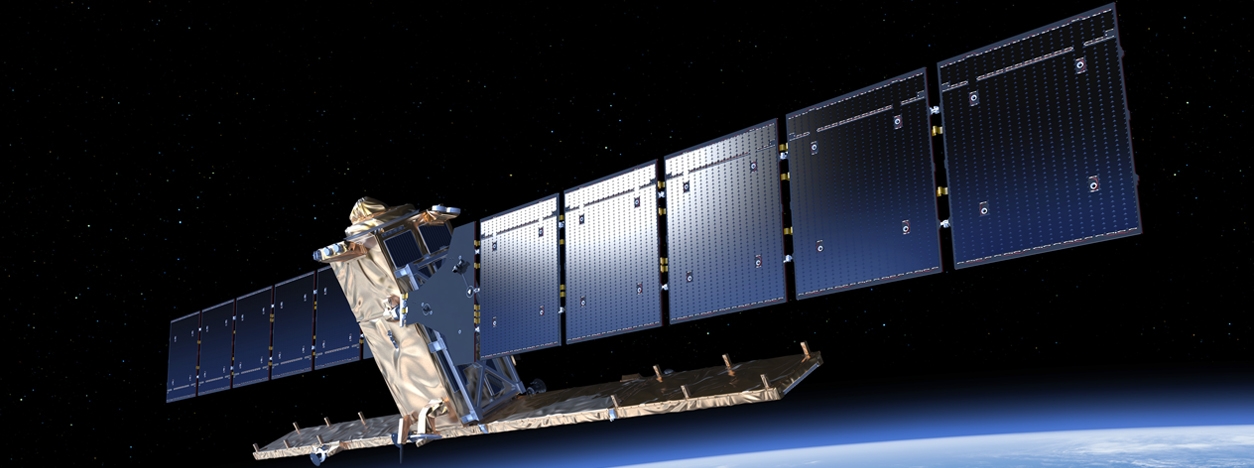
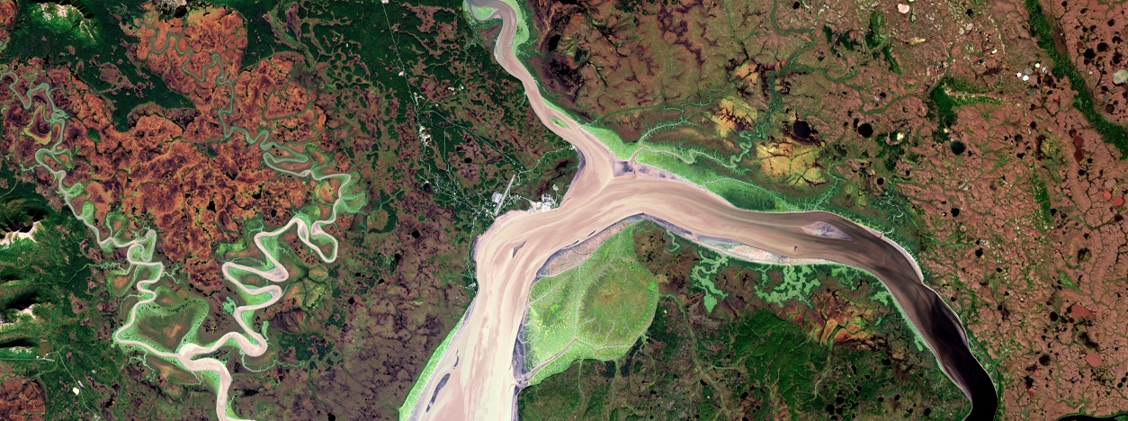
The Sentinel missions, operated by the European Space Agency (ESA), form a constellation of Earth observation satellites within the European Union’s Copernicus program. These missions have a primary objective of delivering precise and timely information about the Earth’s environment to support a wide range of applications, including environmental monitoring, climate change studies, and civil security efforts. Equipped with advanced sensors, the Sentinel satellites capture data across various regions of the electromagnetic spectrum, providing valuable insights into our planet’s dynamics. Importantly, the data collected by the Sentinel missions is made freely accessible to users worldwide, fostering global collaboration and enabling evidence-based decision-making. Each satellite in the Sentinel constellation consists of several satellites meticulously designed with specific purposes and sensor configurations, ensuring a comprehensive and multi-faceted approach to Earth observation.
Sentinel Missions
The different Sentinel satellites and their missions are as follows:
| Sentinel Mission | Launch Year | Mission Specifications |
| Sentinel-1A | 2014 | Sentinel-1 is a radar imaging mission that consists of two identical satellites, Sentinel-1A and Sentinel-1B. It operates in C-band, which allows it to provide all-weather, day-and-night imaging capabilities. Sentinel-1 captures radar images of the Earth’s surface, including land and ocean areas. It is used for a wide range of applications such as monitoring sea ice extent, mapping land cover and land deformation, monitoring maritime activities, and supporting disaster management efforts. |
| Sentinel-1B | 2016 | |
| Sentinel-2A | 2015 | Sentinel-2 is a multispectral optical imaging mission that consists of two satellites, Sentinel-2A and Sentinel-2B. It captures high-resolution imagery in 13 spectral bands, ranging from visible to shortwave infrared. Sentinel-2 imagery is primarily used for land monitoring purposes, including vegetation monitoring, land cover mapping, change detection, and assessing the health of agricultural crops. It provides valuable data for applications such as precision farming, forestry management, urban planning, and disaster mapping. |
| Sentinel-2B | 2017 | |
| Sentinel-3A | 2016 | Sentinel-3 is a multi-instrument mission designed to measure various parameters of the Earth’s oceans, land surfaces, and atmosphere. It consists of two satellites, Sentinel-3A and Sentinel-3B. Sentinel-3 instruments include an ocean and land color instrument (OLCI), a sea and land surface temperature radiometer (SLSTR), and a synthetic aperture radar altimeter (SRAL). It provides measurements of sea surface temperature, ocean color, land surface temperature, vegetation indices, and sea-level variations. Sentinel-3 data is used for applications such as marine and coastal monitoring, climate studies, and land surface characterization. |
| Sentinel-3B | 2018 | |
| Sentinel-4 | Not launched (Upcoming mission) | Sentinel-4 is a geostationary satellite mission that is part of the Meteosat Third Generation (MTG) program. It will be positioned in a geostationary orbit, which allows continuous monitoring of a fixed area. Sentinel-4 is specifically dedicated to monitoring atmospheric composition. It will measure trace gas concentrations, such as ozone, nitrogen dioxide, and sulfur dioxide, as well as aerosol properties in the Earth’s atmosphere. The data from Sentinel-4 will contribute to air quality monitoring, climate studies, and the monitoring of atmospheric composition changes over time. |
| Sentinel-5P | 2017 | Sentinel-5 is a polar-orbiting satellite mission that focuses on measuring the composition of the Earth’s atmosphere. Sentinel-5 instruments include the Tropospheric Monitoring Instrument (TROPOMI), which provides high-resolution measurements of a wide range of trace gases, aerosols, and cloud properties. It monitors greenhouse gases, such as carbon dioxide and methane, ozone concentrations, air pollutants, and other trace gases relevant to atmospheric chemistry. Sentinel-5 data is crucial for air quality monitoring, climate studies, and supporting policies to improve air pollution and understand atmospheric processes. |
| Sentinel-6A | 2020 | Sentinel-6 is a mission dedicated to monitoring sea level rise, wave height, and ocean surface topography. It continues the long-term measurements of sea level that began with the TOPEX/Poseidon, Jason-1, Jason-2, and Jason-3 missions. Sentinel-6 consists of two satellites, Sentinel-6A and Sentinel-6B. The satellite carries a radar altimeter, which measures the height of the ocean surface with high accuracy. By monitoring sea level changes, Sentinel-6 contributes to the understanding of ocean dynamics, climate change, and the impact on coastal areas. |
| Sentinel-6B | Not launched | |
| Sentinel-7 | Not launched (Upcoming mission) | Sentinel-7 is an upcoming mission that will focus on monitoring the Earth’s carbon cycle. It will provide data on greenhouse gas concentrations, such as carbon dioxide and methane, and other atmospheric parameters relevant to the global carbon cycle. The mission aims to track greenhouse gas emissions, study the sources and sinks of carbon, and monitor changes in the Earth’s carbon balance. By improving our understanding of the carbon cycle, Sentinel-7 will contribute to climate change studies and support efforts to mitigate greenhouse gas emissions. |
TECHNICAL DETAILS
The table below provides technical details of the different Sentinel missions, including information about the primary sensor, bands, spatial resolution, radiometric resolution, and temporal resolution for each mission. These technical specifications are important for understanding the capabilities and characteristics of each Sentinel mission’s instruments. These technical specifications highlight the diverse sensor capabilities and resolutions of the Sentinel missions, enabling them to capture a wide range of Earth observations for various applications such as monitoring land and ocean surfaces, measuring atmospheric composition, and studying climate change.
| Sentinel Mission | Primary Sensor | Bands | Spatial Resolution | Radiometric Resolution | Temporal Resolution |
| S-1 | Synthetic Aperture Radar (SAR) | N/A | Varies (10-40 meters) | 16 bits | Varies (3-12 days) |
| S-2 | MultiSpectral Instrument (MSI) | 13 (4 visible/near-infrared, 6 red-edge/shortwave-infrared, 3 atmospheric correction) | 10-60 meters | 12 bits | 5 days |
| S-3 | Ocean and Land Colour Instrument (OLCI), Sea and Land Surface Temperature Radiometer (SLSTR), Synthetic Aperture Radar Altimeter (SRAL), Microwave Radiometer (MWR), Precise Orbit Determination (POD) package (GNSS, DORIS, LRR) | Multiple bands in visible, near-infrared, and thermal infrared spectra | Varies (300-1,000 meters) | 12 bits | 1-2 days |
| S-4 | Ultraviolet/Visible/Near-Infrared (UVN) and Infrared Sounder (IRS) | Multiple bands in ultraviolet, visible, and near-infrared spectra | Varies (1-10 kilometers) | 12 bits | N/A (geostationary orbit) |
| S-5P | Tropospheric Monitoring Instrument (TROPOMI) | Multiple bands in ultraviolet, visible, near-infrared, and shortwave-infrared spectra | Varies (3.5-7 kilometers) | 16 bits | Daily |
| S-6 | Poseidon-4 radar altimeter and a microwave radiometer (MWR) | N/A | N/A | N/A | 10 days |
MAIN APPLICATIONS AND DATA ACCESS

The Sentinel missions provide valuable data for various applications, including:
- Environmental Monitoring: The Sentinel missions contribute to monitoring and assessing environmental changes, such as deforestation, land degradation, water quality, and air pollution. This data is crucial for understanding the Earth’s ecosystems and implementing sustainable management practices.
- Climate Change Studies: The data from Sentinel satellites helps scientists study and monitor climate change by measuring parameters like sea surface temperature, greenhouse gas concentrations, and ice cover. This information is essential for climate models, predicting climate patterns, and evaluating the effectiveness of climate change mitigation strategies.
- Disaster Management: Sentinel-1’s radar imaging capabilities are particularly valuable for disaster management. It provides all-weather and day-and-night imagery, allowing authorities to monitor and respond to natural disasters such as floods, earthquakes, and oil spills. The data helps with emergency response coordination and damage assessment.
- Agriculture and Food Security: Sentinel-2’s high-resolution optical imagery is used for monitoring vegetation health, crop mapping, and detecting agricultural changes. This information supports precision farming, early detection of crop diseases, and assessing food security by monitoring agricultural production.
- Maritime Surveillance: Sentinel-1’s radar imagery is employed for maritime surveillance, including monitoring illegal fishing activities, tracking ship movements, and detecting oil spills. This aids in enforcing maritime regulations, protecting marine ecosystems, and ensuring safe navigation.
- Urban Planning: Sentinel data assists in urban planning and monitoring urban growth. The high-resolution imagery from Sentinel-2 enables detailed land cover mapping, infrastructure monitoring, and land-use planning to support sustainable urban development.
- Water Resource Management: Sentinel-2 and Sentinel-3 data help monitor water resources, including lakes, rivers, and coastal areas. It aids in assessing water quality, monitoring water levels, and managing water resources for agriculture, drinking water, and ecosystem preservation.
Accessing the data from the Sentinel missions is free and open to everyone. The European Space Agency’s Copernicus Open Access Hub is the primary platforms for accessing and downloading Sentinel data. Users can access and download various types of data, including imagery, radar data, atmospheric measurements, and land surface parameters, depending on the specific mission and sensor. Data formats are typically in standardized formats like GeoTIFF, NetCDF, and JPEG2000, making it compatible with popular GIS and remote sensing software.
It’s worth noting that while the data is freely accessible, some users may need to register and obtain an account to access the full range of data products and services.
RELATED LINKS AND ADDITIONAL RESOURCES
Further background information about Landsat
- Sentinel Online: This website provides comprehensive information about the Copernicus Sentinel missions, including mission objectives, spacecraft design, instrument payloads and data products. You can also find the latest mission news and updates.
- Sentinel Missions Overview: This website provides an overview of all the Sentinel missions and their objectives.
Accessing and working with Landsat data
- Copernicus Open Access Hub: This website provides access to Sentinel data and services. You can search for and download Sentinel data products using the interactive map or the advanced search options. The website provides complete, free and open access to Sentinel-1, Sentinel-2, Sentinel-3 and Sentinel-5P user products. It is intended for users who need to download a large amount of data, mainly for scientific research or application development.
- ESA’s Earth Online: This website provides access to a wide range of Earth observation data, including Sentinel data. You can search for and download data products using the interactive map or the advanced search options.
- USGS EarthExplorer: This website provides access to a wide range of Earth observation data, including Sentinel data. You can search for and download data products using the interactive map or the advanced search options.
*Images from

