Socio-Demographic Analysis
GENERAL INFORMATION

Socio-demographic analysis, which goes beyond mere population counts, offers a nuanced perspective on the social and demographic characteristics within a specific geographical area. It reveals disparities, clustering, and dynamic changes, shedding light on critical patterns and trends within the unique socio-demographic fabric of specific regions.
Geographic Information Systems (GIS) have become indispensable in this realm, particularly for urban planning and climate change adaptation studies. Their ability to conduct comprehensive socio-demographic analysis is pivotal in understanding the intricate relationship between human populations and their evolving urban environments.
As urban landscapes continue to evolve, the powerful capabilities of GIS to integrate various types of data and perform complex spatial analyses become increasingly important. These tools enable planners and decision-makers to understand the social and demographic dynamics of a region, thereby facilitating informed decisions.
Spatial analysis tools in GIS, such as hotspot analysis, can identify areas with high population growth or socio-demographic characteristics that make them particularly vulnerable to climate change impacts. For instance, areas with a high proportion of elderly people or low-income households might be more vulnerable to extreme weather events. Such insights guide a wide range of planning decisions. They can help determine where to focus resources for public services, where to enhance infrastructure to withstand extreme weather events, or where to implement social programs aimed at reducing vulnerability.
TYPES OF ANALYSIS
This section provides an overview of various socio-demographic analyses that are essential for urban planning and climate change adaptation. These analyses, conducted using Geographic Information Systems (GIS), offer valuable insights into population characteristics and their spatial distribution. They serve as a comprehensive toolkit for understanding and responding to the socio-demographic dynamics of urban landscapes.
Common Socio-Demographic Analysis (to name but a few)
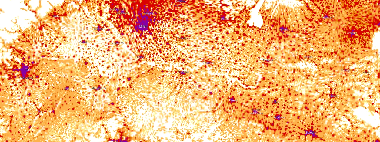
- Population Density: Serving as the cornerstone of urban planning, population density analysis meticulously examines spatial concentrations. This analysis is instrumental in guiding decisions related to infrastructure development, housing provision, and public service allocation.
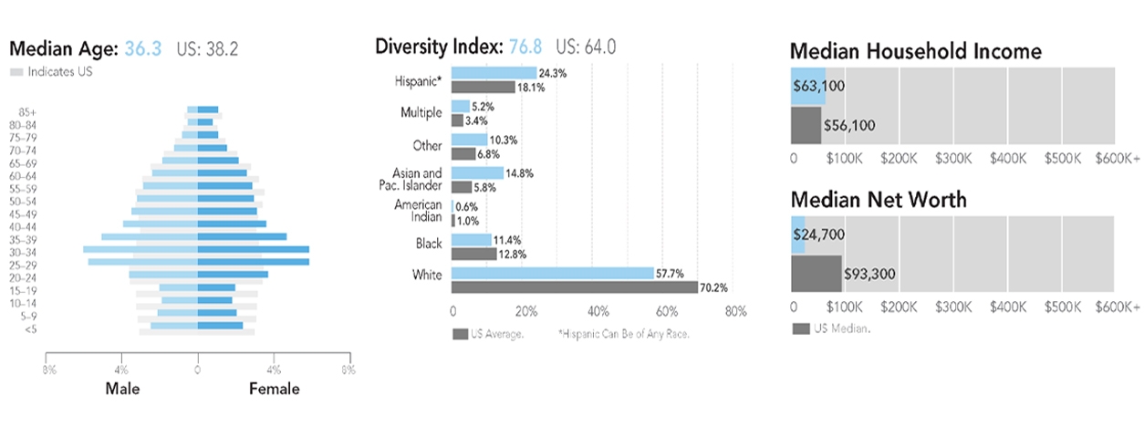
- Age Structure Analysis: This involves examining the distribution of different age groups in the population. It can provide insights into the population’s stage in the demographic transition, which can have implications for healthcare, education, and labor market needs.
- Gender Analysis: This analysis looks at the distribution and roles of different genders in the population. It can inform policies related to gender equality and social inclusion.
- Ethnicity and Race Analysis: This involves studying the distribution and characteristics of different ethnic and racial groups. It can help address issues related to social cohesion and integration.
- Income and Wealth Analysis: This examines the distribution of income and wealth among the population. It can provide insights into economic inequality and inform policies related to poverty reduction and economic development.
- Population Distribution: The process of mapping the distribution of various demographic attributes unveils underlying spatial patterns. These insights significantly influence zoning regulations and resource allocation, thereby promoting a balanced and harmonious urban ecosystem.
- Population Growth and Decline: The dynamic tracking of population changes over time reveals trends that significantly shape urban expansion. Conversely, areas of population decline may indicate issues that need to be addressed. These insights provide crucial inputs for sustainable development planning.
- Demographic Trends: An in-depth exploration of long-term demographic trends is key to forecasting urban needs. It informs policies that accommodate evolving age structures, migration patterns, and societal shifts, ensuring urban adaptability.
Advanced Spatial Analysis (to name but a few)
- Cluster Analysis: This technique identifies regions with similar demographic attributes, facilitating targeted interventions and specialized urban planning. It optimizes resource utilization by focusing on areas with shared characteristics.
- Moran Spatial Autocorrelation: An advanced method that measures the degree of similarity between socio-demographic attributes in neighboring regions. It enhances understanding of regional cohesion, contributing to the formulation of comprehensive regional plans.
- Hotspot Analysis: This analysis pinpoints statistically significant hotspots or cold spots of socio-demographic features, enabling precise identification of challenges. It directs interventions towards areas that are either vulnerable or thriving, ensuring efficient resource allocation.
- Spatial Regression Modeling: This technique deciphers the intricate relationships between socio-demographic variables by incorporating spatial relationships into regression models. It refines predictive accuracy, leading to more informed decision-making.
- Geographically Weighted Regression (GWR): A localized variant of spatial regression, also defined as local regression models as opposed to global models, which generates parameters disaggregated by spatial units of analysis. It’s a powerful tool for exploring spatial heterogeneity in data.
- Accessibility Analysis: This evaluation assesses the accessibility of socio-demographic amenities, promoting equitable distribution. It fosters the creation of inclusive urban environments that cater to the population’s diverse needs.
- Temporal-Spatial Analysis: This approach integrates temporal dimensions into spatial analyses, offering a dynamic perspective on socio-demographic changes over time. It supports the development of adaptive planning strategies that respond effectively to evolving urban landscapes.
MAIN SOURCES OF DATA
Reliable and extensive data sources are the cornerstone of socio-demographic analysis, enhancing the depth and precision of studies. National statistical institutes are generally the key sources of this crucial information, providing a wealth of demographic and spatial data. The sources mentioned here are relevant to the MultiCAST project. However, it’s important to note that, in general, different countries may have their national statistical institutes, which serve as primary sources for socio-demographic data in their respective regions.
- Italy’s National Institute of Statistics (Istat): Istat serves as a comprehensive source for Italian socio-demographic data, encompassing vital statistics, census data, and geographic information.
- Spain’s National Institute of Statistics (INE): INE provides robust statistical insights into Spain’s demographic landscape, facilitating targeted urban planning.
- Statistics Netherlands (CBS): CBS is an authoritative hub for Dutch demographic and spatial statistics, empowering planners with region-specific data.
- U.S. Census Bureau: As the primary source for demographic data in the U.S., the Census Bureau offers an extensive array of datasets vital for nuanced analyses.
RELEVANT APPLICATIONS

Socio-demographic analysis, enriched by the capabilities of Geographic Information Systems (GIS), spans a multitude of applications across various domains, fundamentally shaping the trajectory of urban development and fostering adaptive strategies for climate change. These applications serve as integral components in the pursuit of resilient and sustainable communities.
- Urban Growth Management: Urban growth, driven by population dynamics, necessitates proactive and informed management strategies. Socio-demographic analysis and GIS provide a dynamic understanding of areas prone to population growth. Urban planners can strategically allocate resources, plan infrastructure developments, and implement zoning regulations by identifying regions with heightened growth potential. This approach anticipates the challenges posed by expanding urban footprints and promotes efficient land use, minimizing environmental impacts and enhancing overall urban sustainability.
- Vulnerability Assessment: The impacts of climate change pose complex challenges, with socio-demographic vulnerabilities playing a pivotal role in shaping the resilience of communities. Through sophisticated spatial analysis, socio-demographic factors are intricately woven into vulnerability assessments. Evaluating the susceptibility of populations in specific regions helps formulate targeted climate change adaptation strategies. GIS enables the identification of high-risk zones, allowing for the implementation of measures that enhance the resilience of exposed populations. This comprehensive approach ensures that adaptation strategies are effective and attuned to the unique socio-demographic characteristics of vulnerable areas.
- Resource Allocation: Informed decision-making for resource allocation is crucial for fostering equitable and sustainable urban development. Socio-demographic analysis acts as a guiding compass, providing insights into the diverse needs of different population groups. By understanding the spatial distribution of demographic characteristics, policymakers can strategically allocate resources such as healthcare facilities, educational institutions, and public services. This approach ensures that resource distribution is efficient and addresses socio-demographic disparities, promoting inclusive and sustainable urban development.
- Community Engagement: A nuanced understanding of demographic composition is the cornerstone of effective community engagement. Socio-demographic analysis facilitates the identification of diverse community needs and preferences. GIS tools contribute by spatially representing these nuances, allowing for the customization of engagement initiatives. Tailoring interventions based on demographic insights ensures that community engagement efforts are culturally sensitive and align with the unique requirements of diverse populations. This inclusive approach fosters stronger community bonds, social cohesion, and active participation in urban development processes.
- Policy Formulation: Socio-demographic insights are the bedrock for evidence-based policy formulation in urban planning and climate adaptation. The integration of GIS enhances the precision and relevance of these insights. Policymakers can craft targeted and effective policies by understanding demographic trends, migration patterns, and socio-economic dynamics. GIS-based spatial analysis provides a spatial context, allowing for the identification of areas with specific needs or vulnerabilities. This comprehensive understanding of the socio-demographic landscape ensures that policies are well-informed and capable of addressing the unique challenges posed by urbanization and climate change.
- Transportation Planning: Demographic factors significantly influence transportation patterns and needs. Socio-demographic analysis, in conjunction with GIS, helps planners understand commuting behaviors, preferred modes of transportation, and traffic patterns. This information is crucial for designing efficient transportation systems, optimizing public transit routes, and addressing the transportation needs of diverse demographic groups. GIS tools enable the visualization of spatial data, allowing transportation planners to create informed strategies for infrastructure development and traffic management.
RELATED LINKS AND ADDITIONAL RESOURCES
- United Nations Department of Economic and Social Affairs (UNDESA): A global knowledge repository offering context on demographic trends and challenges, informing localized studies.
- United Nations Department of Economic and Social Affairs (UNDESA): The UN Population Division’s website provides in-depth demographic data, publications, and reports, offering valuable insights into global population trends.
- Esri – GIS and Demographics: A comprehensive resource for GIS tools, empowering analysts with capabilities to conduct sophisticated spatial analyses.
- World Bank Data: The World Bank’s official data portal provides access to a wide range of socio-economic and demographic datasets, facilitating cross-country comparative analyses.
- NASA Earthdata: NASA’s Earthdata website is a comprehensive resource for satellite imagery and environmental data, complementing socio-demographic analysis for a holistic understanding of urban dynamics. Explore their data archives and tools for valuable information.
- NASA Socioeconomic Data and Applications Center (SEDAC): SEDAC, operated by the NASA Earth Science Division, provides socioeconomic and environmental data, supporting interdisciplinary research.
*Images from

