Solar Radiation
GENERAL INFORMATION

Solar radiation is the primary energy source driving Earth’s climate systems and urban microclimates. It refers to the electromagnetic energy emitted by the sun, which reaches the Earth’s surface as direct, diffuse, and reflected radiation. Solar radiation is the electromagnetic energy emitted by the sun, spanning ultraviolet (UV, 100–400 nm), visible (VIS, 400–700 nm), and infrared (IR, 700 nm–1 mm) wavelengths. In urban climatology, we distinguish:
- Shortwave Radiation (SW): 0.3–3 µm band, comprising UV, VIS, and near-IR. Measured as downward SW flux (↓SW) and upward reflected SW (↑SW).
- Longwave Radiation (LW): 3–100 µm band, emitted by surfaces and atmosphere. Downward LW (↓LW) and upward surface LW (↑LW).
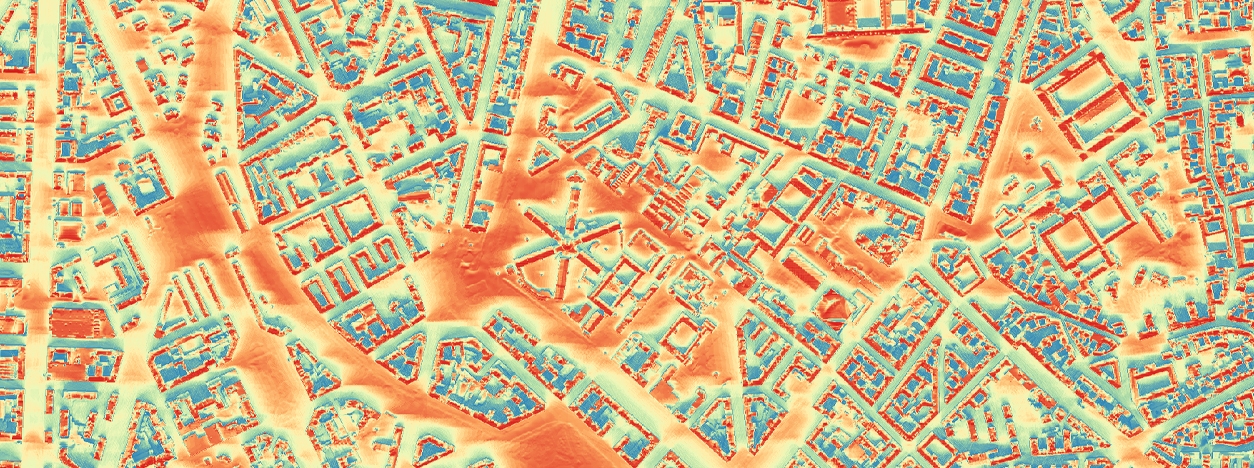
Quantifying solar radiation in urban environments is critical for understanding energy budgets, thermal comfort, and renewable energy potential. Solar irradiance is measured in watts per square meter (W/m²) and varies spatially and temporally due to factors like latitude, time of day, season, atmospheric conditions, and urban geometry.
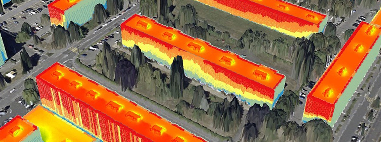
In cities, buildings, trees, and infrastructure create complex shading and reflection patterns, altering solar exposure. Urban planners and climatologists analyze solar radiation to optimize energy efficiency, mitigate heat islands, and enhance livability. Key components include:
- Direct Radiation: Sunlight reaching the surface unimpeded.
- Diffuse Radiation: Sunlight scattered by the atmosphere.
- Global Radiation: Sum of direct and diffuse
- Reflected Radiation: Light bounced off surfaces (dependent on albedo).
Solar radiation analysis helps quantify energy availability for solar panels, daylighting in buildings, and heat gain in urban canyons. It is foundational for sustainable urban design, climate resilience, and public health strategies.
SOLAR RADIATION AND URBAN CLIMATE
Solar radiation directly influences urban thermal environments, energy consumption, and human comfort. Its distribution is shaped by urban geometry, surface materials, and vegetation. Key impacts include:
- Urban Heat Island (UHI) Effect: High solar absorption by dark surfaces (e.g., asphalt) increases local temperatures.
- Thermal Comfort: Excessive solar exposure raises heat stress, while shading improves comfort. Common thermal comfort indices include the Physiological Equivalent Temperature (PET), which solves for air temperature of reference environment giving equivalent heat stress, and the Universal Thermal Climate Index (UTCI), which is based on advanced multi-node human energy balance model, strongly influenced by Mean Radiant Temperature.
- Energy Demand: Solar gain in buildings affects cooling loads in summer and heating needs in winter.
Factors Influencing Solar Radiation in Cities:
- Urban Geometry: Building height, spacing, and orientation determine shading and solar access.
- Surface Albedo: High-albedo materials (e.g., white roofs) reflect more sunlight, reducing heat absorption.
- Vegetation: Trees provide shade and evapotranspiration, cooling microclimates.
- Atmospheric Conditions: Clouds, aerosols, and pollution scatter or absorb solar radiation.
For example, dense high-rise areas experience reduced direct radiation due to shading, while open plazas receive higher solar exposure. Balancing these effects is crucial for energy-efficient urban design.
MEASUREMENT, MODELLING METHODS AND TOOLS
Accurate measurement of solar radiation is essential for validating models, calibrating urban energy simulations, and understanding radiation-driven processes such as thermal comfort and urban heat storage. Radiation fluxes are typically observed using high-precision radiometric instruments deployed in both standardized meteorological stations and dedicated urban monitoring networks.
- Pyranometer: Measures global shortwave irradiance (direct + diffuse) on a horizontal plane and, when shaded, captures diffuse shortwave separately. Must conform to ISO 9060 standards and be calibrated according to World Meteorological Organization (WMO) protocols.
- Pyrheliometer: Measures Direct Normal Irradiance (DNI) with high angular precision by tracking the solar disk using a sun tracker. Critical for quantifying direct beam radiation in cloud-free conditions.
- Net Radiometer: Combines upward and downward-facing sensors for shortwave and longwave to directly measure net radiation. Useful in surface energy balance studies, especially for urban material and canopy-level fluxes.
- Reanalysis Products (e.g., ERA5): Provide spatially continuous, physically consistent estimates of surface downward shortwave and longwave radiation, alongside aerosol optical depth (AOD) and cloud microphysics (e.g., water/ice content, optical thickness). Useful for boundary forcing in urban models or validation in data-sparse areas.
The accurate assessment of solar radiation at city scale requires diverse modeling approach and tools tailored to spatial resolution, physical complexity, and urban form. Urban-scale solar radiation modeling employs diverse computational approaches, including:
- Analytical models (e.g., r.sun, potential incoming solar radiation): Solve solar geometry and shading based on terrain and urban morphology.
- Ray tracing (e.g., Radiance): Model photon transport, including direct, diffuse, and reflected radiation in 3D environments.
- Energy balance models (e.g., ENVI-met, CitySim, EnergyPlus): Simulate coupled surface-atmosphere energy fluxes, including shortwave and longwave radiation.
- Building energy simulation tools (e.g., EnergyPlus): Integrate solar radiation with dynamic shading, glazing properties, and thermal mass, extended to neighborhood scale via urban geometry inputs.
- Empirical/statistical models (e.g., PVGIS, SAM): Use climatological datasets to estimate photovoltaic potential and solar resource.
- Hybrid models (e.g., SOLWEIG): Combine simplified radiation transport with urban geometry and surface properties for thermal comfort modeling.
The table below summarizes key tools used in urban climatology and energy modeling, ranging from physically based radiation solvers to GIS-integrated estimators. These tools support applications such as solar potential analysis, thermal comfort assessment, urban heat island diagnostics, and PV performance forecasting. Their applicability spans from building facades to entire metropolitan areas, depending on the model’s spatial granularity, input requirements (e.g., DSM, material properties, meteorology), and computational architecture.
| Tool | Function | Scale |
| EnergyPlus | Radiation and energy simulation with shadowing | Building–neighborhood |
| SOLWEIG | SW+LW radiation & Tmrt | Neighborhood-City |
| ENVI-met | 3D microclimate (radiation + fluxes) | Street scale |
| CitySim | Urban energy + radiation coupling | City scale |
| PVGIS/SAM | PV performance, PV yield estimation | Regional |
| SAGA GIS | Potential Incoming Solar Radiation | Local to City |
| GRASS GIS – r.sun | SW irradiance from DSM, shadowing | Local to city |
| Radiance | Solar control, lighting, and daylighting design | Building |
MAIN APPLICATIONS

Key applications span solar resource assessment for energy systems, strategies to mitigate urban heat, optimization of daylight and visual comfort, analysis of outdoor and indoor thermal conditions, simulation of building energy performance, solar-informed urban planning, climate resilience modeling, public health and outdoor comfort interventions, integration of photovoltaics with urban agriculture, and the development of educational and outreach tools.
-
Solar Energy Resource Assessment. Quantifies available direct, diffuse, and reflected irradiance at rooftop, façade, and district scales to inform siting, sizing, and performance forecasting of photovoltaic (PV) and solar-thermal systems.
-
Urban Heat Island Mitigation. Evaluates how modifications to surface albedo, vegetation cover, and building geometry alter shortwave absorption and long-wave trapping, guiding strategies—such as cool roofs, green corridors, and reflective pavements—to reduce peak urban temperatures.
-
Daylighting and Visual Comfort. Models interior and exterior daylight availability using ray-tracing and radiosity tools to optimize window placement, shading devices, and façade treatments, improving occupant well-being while minimizing glare and reliance on electric lighting.
-
Thermal Comfort Analysis. Integrates solar radiation with microclimate models (e.g., SOLWEIG, ENVI-met) to compute Mean Radiant Temperature (MRT) and comfort indices (PET, UTCI), supporting the design of shaded public spaces, pedestrian corridors, and outdoor thermal refuge zones.
-
Building Energy Performance Simulation. Includes dynamic solar gains in whole-building models (e.g., EnergyPlus, CitySim) to predict heating and cooling loads, inform adaptive façades, and evaluate the impact of glazing properties, shading controls, and thermal mass on annual energy consumption.
-
Urban Planning and Design Optimization. Applies high-resolution solar access analyses (e.g., r.sun, Ladybug Tools) within GIS and BIM environments to assess solar rights, daylight provisions, and shadow impacts across development scenarios—ensuring regulatory compliance and maximizing passive solar benefits.
-
Climate Resilience and Adaptation. Leverages reanalysis data (e.g., ERA5 via Copernicus CDS, NASA POWER) to simulate future solar radiation regimes under climate change, evaluating risks of heat stress and PV performance shifts, and guiding resilient infrastructure and land-use planning.
-
Public Health and Outdoor Amenities. Maps spatial patterns of UV exposure and thermal load in urban canyons to inform public-health interventions—such as shading structures, green infrastructure, and heat-action plans—aimed at reducing heat-related morbidity and improving recreational comfort.
-
Agrivoltaics and Urban Agriculture. Assesses trade-offs between crop light requirements and PV deployment in urban farming contexts, optimizing canopy designs that balance plant productivity with renewable energy generation.
-
Educational and Outreach Tools. Utilizes interactive web-based platforms (e.g., PVGIS, NASA POWER) and open-source plugins (e.g., Ladybug Tools) to engage stakeholders—planners, architects, students—in visualizing solar phenomena and making data-driven decisions for sustainable urban environments.
RELATED LINKS AND ADDITIONAL RESOURCES
- NASA POWER Project: Provides global meteorological and solar data tailored for energy, agriculture, and climate research applications. Useful for assessing solar irradiance and climate variables for specific locations.
- PVGIS – Photovoltaic Geographical Information System: Offers interactive tools to estimate solar energy production, considering local weather and irradiation conditions for any given point in Europe and beyond.
- Ladybug Tools: A suite of open-source tools integrated into CAD environments for environmental design and building performance simulation, including solar radiation and daylight analysis.
- Copernicus Climate Data Store (CDS): Offers access to a wide range of climate datasets, including reanalysis and forecasts, to support climate impact research and modeling.
- EnergyPlus Documentation: Comprehensive resources for EnergyPlus, a simulation engine for modeling building energy consumption, HVAC, lighting, and renewable systems.
- Radiance Lighting Simulation: A suite of tools for advanced lighting simulation, often used for daylighting analysis and optical lighting design in complex environments.
- GRASS GIS – r.sun Module: Calculates solar irradiance and radiation based on terrain and atmospheric conditions; supports spatiotemporal solar modeling in geographic contexts.
- CitySim: A simulation software for urban energy modeling, enabling the analysis of solar radiation, energy flows, and microclimate interactions at the district level.
- UMEP – Solar Radiation Daily Shadow Pattern Processor: A tool within UMEP (Urban Multi-scale Environmental Predictor) used to simulate daily solar radiation and shadow patterns in urban areas using 3D city models.
- Solar Energy Potential Assessment on Rooftops and Facades: Presents a methodology for assessing solar radiation and energy production on building rooftops and vertical facades of the inner-city. This integrated tool is based on the use of LiDAR, 2D and 3D cadastral data.
- ShadeMap – Real-Time Sun and Shadow Visualization: This interactive tool visualizes how sunlight and shadows move across a specific location over time, helping users plan for shade, sun exposure, or photography based on building heights and terrain.
*Images from
https://www.frontiersin.org/journals/built-environment/articles/10.3389/fbuil.2018.00014/full

